


1 Voting District, Montgomery County, Tennessee
About
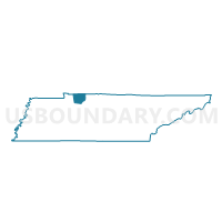
Outline

Summary
| Unique Area Identifier | 669262 |
| Name | 1 Voting District |
| County | Montgomery County |
| State | Tennessee |
| Area (square miles) | 60.97 |
| Land Area (square miles) | 60.92 |
| Water Area (square miles) | 0.04 |
| % of Land Area | 99.93 |
| % of Water Area | 0.07 |
| Latitude of the Internal Point | 36.60022020 |
| Longtitude of the Internal Point | -87.22391640 |
Maps


Graphs
Select a template below for downloading or customizing gragh for 1 Voting District, Montgomery County, Tennessee


Neighbors
Neighoring Voting District (by Name) Neighboring Voting District on the Map
- 07-1 Adams Methodist Church Voting District, Robertson County, TN
- 14 Voting District, Montgomery County, TN
- 18 Voting District, Montgomery County, TN
- 19 Voting District, Montgomery County, TN
- 2 Voting District, Montgomery County, TN
- 20 Voting District, Montgomery County, TN
- 3B Voting District, Montgomery County, TN
Top 10 Neighboring County Subdivision (by Population) Neighboring County Subdivision on the Map
- District 1, Montgomery County, TN (15,902)
- District 18, Montgomery County, TN (15,713)
- District 14, Montgomery County, TN (12,139)
- District 3, Montgomery County, TN (10,797)
- District 20, Montgomery County, TN (9,214)
- District 2, Montgomery County, TN (7,343)
- District 19, Montgomery County, TN (6,054)
- District 7, Robertson County, TN (5,646)
- Guthrie CCD, Todd County, KY (2,627)
- Trenton CCD, Todd County, KY (1,404)
Top 10 Neighboring Place (by Population) Neighboring Place on the Map
Top 10 Neighboring Unified School District (by Population) Neighboring Unified School District on the Map
- Montgomery County School District, TN (166,179)
- Robertson County School District, TN (66,283)
- Todd County School District, KY (12,460)
Top 10 Neighboring State Legislative District Lower Chamber (by Population) Neighboring State Legislative District Lower Chamber on the Map
- State House District 68, TN (85,127)
- State House District 67, TN (67,863)
- State House District 66, TN (66,283)
- State House District 16, KY (39,295)
Top 10 Neighboring State Legislative District Upper Chamber (by Population) Neighboring State Legislative District Upper Chamber on the Map
- State Senate District 18, TN (222,166)
- State Senate District 22, TN (219,862)
- State Senate District 3, KY (113,250)
Top 10 Neighboring 111th Congressional District (by Population) Neighboring 111th Congressional District on the Map
- Congressional District 7, TN (792,605)
- Congressional District 6, TN (788,754)
- Congressional District 1, KY (686,989)
Top 10 Neighboring Census Tract (by Population) Neighboring Census Tract on the Map
- Census Tract 1019.03, Montgomery County, TN (8,085)
- Census Tract 1020.02, Montgomery County, TN (7,396)
- Census Tract 1018.04, Montgomery County, TN (6,465)
- Census Tract 802, Robertson County, TN (5,943)
- Census Tract 1020.06, Montgomery County, TN (5,817)
- Census Tract 1020.04, Montgomery County, TN (5,213)
- Census Tract 1020.05, Montgomery County, TN (5,062)
- Census Tract 1020.03, Montgomery County, TN (4,875)
- Census Tract 1020.01, Montgomery County, TN (4,744)
- Census Tract 9503, Todd County, KY (2,627)
Top 10 Neighboring 5-Digit ZIP Code Tabulation Area (by Population) Neighboring 5-Digit ZIP Code Tabulation Area on the Map
- 37042, TN (66,916)
- 37040, TN (44,924)
- 37043, TN (39,945)
- 37010, TN (4,679)
- 42234, KY (2,469)
- 42286, KY (1,291)